TOWNE POINT PLAT MAPS
TPOA I
TPOA II 1 of 2
TPOA II 2 of 2
The Planned Unit Development was built in two phases. Above are three plat maps that were the basis for our properties. Subsequent to the original plat maps, some properties have been reconfigured.
For General Informational Purposes Only - These maps are provided on an ‘as is,’ ‘with all faults,’ basis. Towne Point Owners Association and its agents do not warrant in any way the accuracy of the information contained in them. Field verification of their accuracy is the sole responsibility of the user. User releases TPOA and its agents from any liability based on the user’s use of map information.
Towne Point designated the Common Area as all the real property owned by the Association for the common use and enjoyment of the owners, their family and invitees. This includes the roads, clubhouse, tennis court, and open area green belts. This property belongs to all of us – no single person should try to claim sole use. If you have any questions about this, please refer them to your Title Company.
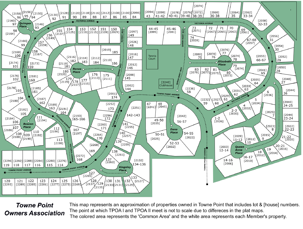
Towne Point Lots & Common Areas
The above map depicts the shape, addresses & lot numbers of the subdivision. The green areas are the common areas. The subdivision is sited on one hectare (40 acres) within the city limits of Port Townsend.